


Product Details
+
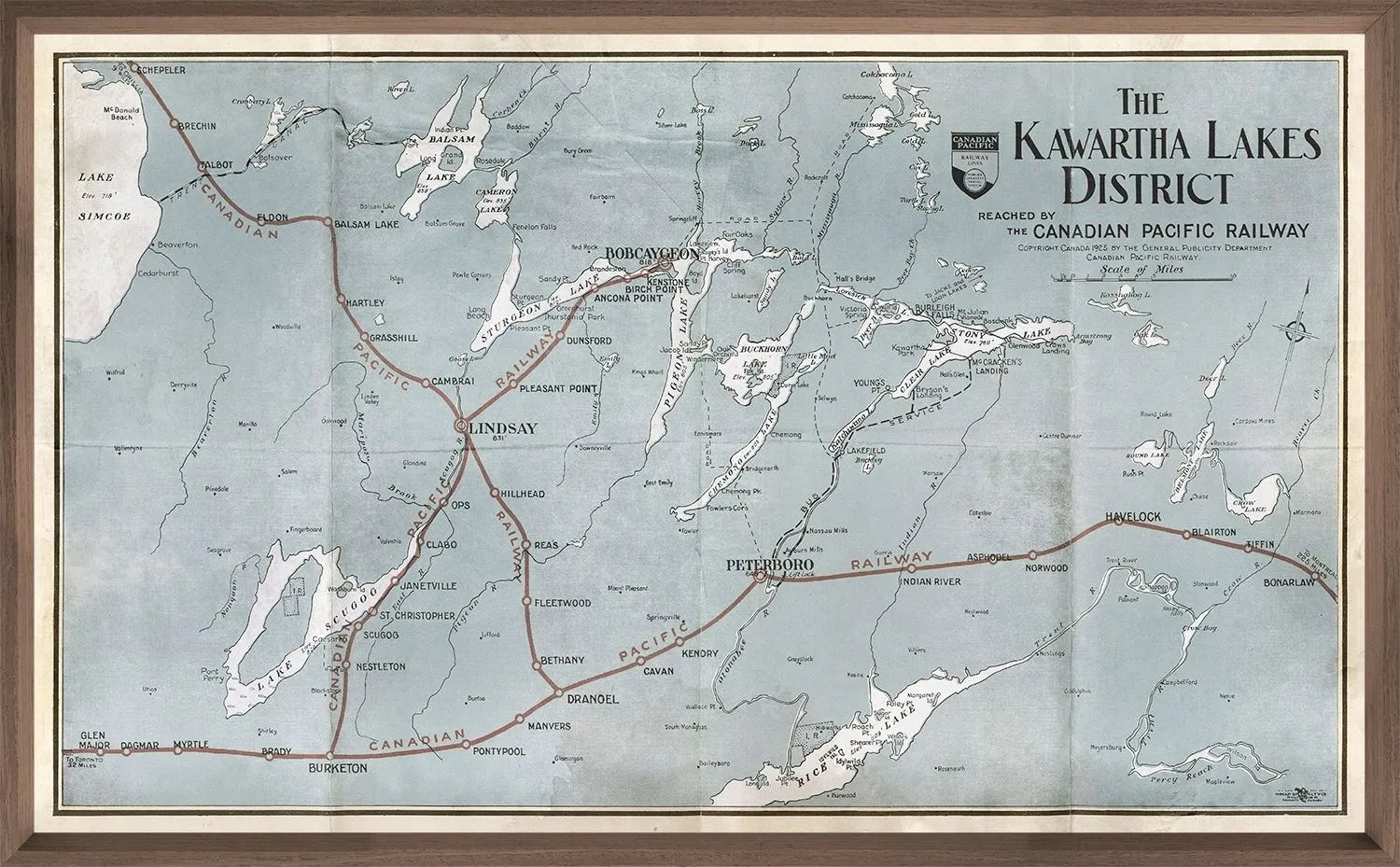
This 1925 Canadian Pacific Railway map covers the wilds of beautiful Kawartha region from Lake Simcoe to the eastern reaches of the Trent river systems. Favourite lakes like Rice, Sturgeon, Chemong and Catchacoma are included in this beauty. By land or by sea this will be a sure fire, cottage country winner.


, Speed Warning, Speedometer,Battery Display and GPS etc (Upgraded on July)")

![RAM Mount 1.5" Ball Double Socket Arm w/2.5" Round Base [RAM-103U]](https://www.smartautomot.shop/image/ram-mount-15quot-ball-double-socket-arm-w25quot-round-base-ram-103u_qR1YTI_285x.webp "RAM Mount 1.5\" Ball Double Socket Arm w/2.5\" Round Base [RAM-103U]")


